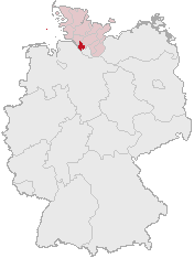
Ta'ãnga:Lage des Kreises Pinneberg in Deutschland.png
Lage_des_Kreises_Pinneberg_in_Deutschland.png (176 × 234 píxeles; tamaño de archivo: 4 kB; tipo MIME: image/png)
Marandurenda rembiasakue
Ejopy peteĩ ára/aravo rehe rehecha hag̃ua pe marandurenda ojehechaukaháicha upe jave.
| Ára/Aravo | Michĩháicha | Tuichakue | Puruhára | Jehaimombyky | |
|---|---|---|---|---|---|
| ko’ag̃agua | 12:21 5 jasyrundy 2007 |  | 176 × 234 (4 kB) | Ditschi | transparent |
| 09:19 3 jasyapy 2006 |  | 176 × 234 (4 kB) | Rauenstein | Karte erstellt auf der Grundlage der opengeodb.de-Umrisse - GNU-FDL Geograv 00:54, 31. Dez 2004 {{Bild-GFDL}} Category:Maps of Germany |
Marandurenda jeporu
La siguiente página usa este archivo:
Marandurenda jepuru opaite tembiapópe
Ko'ã ambue wiki oipuru ko marandurenda:
- Jeporu ace.wikipedia.org rehe
- Jeporu am.wikipedia.org rehe
- Jeporu ang.wikipedia.org rehe
- Jeporu arc.wikipedia.org rehe
- Jeporu av.wikipedia.org rehe
- Jeporu ay.wikipedia.org rehe
- Jeporu bcl.wikipedia.org rehe
- Jeporu bi.wikipedia.org rehe
- Jeporu bm.wikipedia.org rehe
- Jeporu bpy.wikipedia.org rehe
- Jeporu bxr.wikipedia.org rehe
- Jeporu cbk-zam.wikipedia.org rehe
- Jeporu ceb.wikipedia.org rehe
- Jeporu ch.wikipedia.org rehe
- Jeporu cr.wikipedia.org rehe
- Jeporu cs.wikipedia.org rehe
- Jeporu cu.wikipedia.org rehe
- Jeporu cv.wikipedia.org rehe
- Jeporu cy.wikipedia.org rehe
- Jeporu dsb.wikipedia.org rehe
- Jeporu dv.wikipedia.org rehe
- Jeporu dz.wikipedia.org rehe
- Jeporu eml.wikipedia.org rehe
- Jeporu eo.wikipedia.org rehe
- Jeporu es.wikipedia.org rehe
- Jeporu ext.wikipedia.org rehe
- Jeporu ff.wikipedia.org rehe
- Jeporu fiu-vro.wikipedia.org rehe
- Jeporu fj.wikipedia.org rehe
- Jeporu fo.wikipedia.org rehe
- Jeporu frp.wikipedia.org rehe
- Jeporu frr.wikipedia.org rehe
- Jeporu fr.wikipedia.org rehe
- Jeporu fur.wikipedia.org rehe
- Jeporu fy.wikipedia.org rehe
- Jeporu gag.wikipedia.org rehe
- Jeporu got.wikipedia.org rehe
- Jeporu hak.wikipedia.org rehe
- Jeporu haw.wikipedia.org rehe
- Jeporu hif.wikipedia.org rehe
- Jeporu hi.wikipedia.org rehe
- Jeporu hr.wikipedia.org rehe
- Jeporu ht.wikipedia.org rehe
- Jeporu hy.wikipedia.org rehe
- Jeporu id.wikipedia.org rehe
- Jeporu ie.wikipedia.org rehe
- Jeporu incubator.wikimedia.org rehe
Ver más uso global de este archivo.

