
Ta'ãnga:Central Asia (orthographic projection).svg

Tamaño de esta previsualización PNG del archivo SVG: 553 × 553 píxeles. Otras resoluciones: 240 × 240 píxeles | 480 × 480 píxeles | 768 × 768 píxeles | 1024 × 1024 píxeles | 2048 × 2048 píxeles.
Marandurenda moambue'ỹre (archivo SVG, nominalmente 553 × 553 píxeles, tamaño de archivo: 344 kB)
Resumen
| Mombe'uanga |
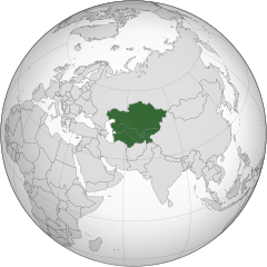
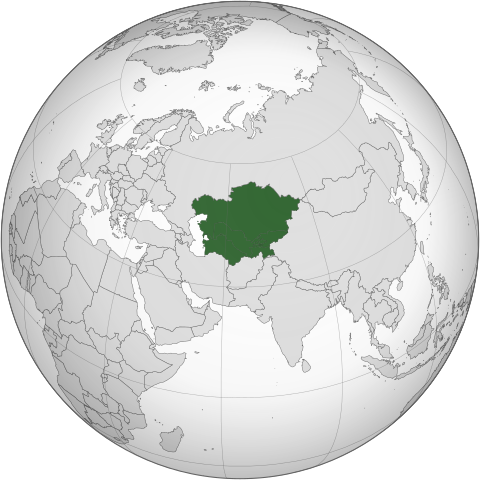
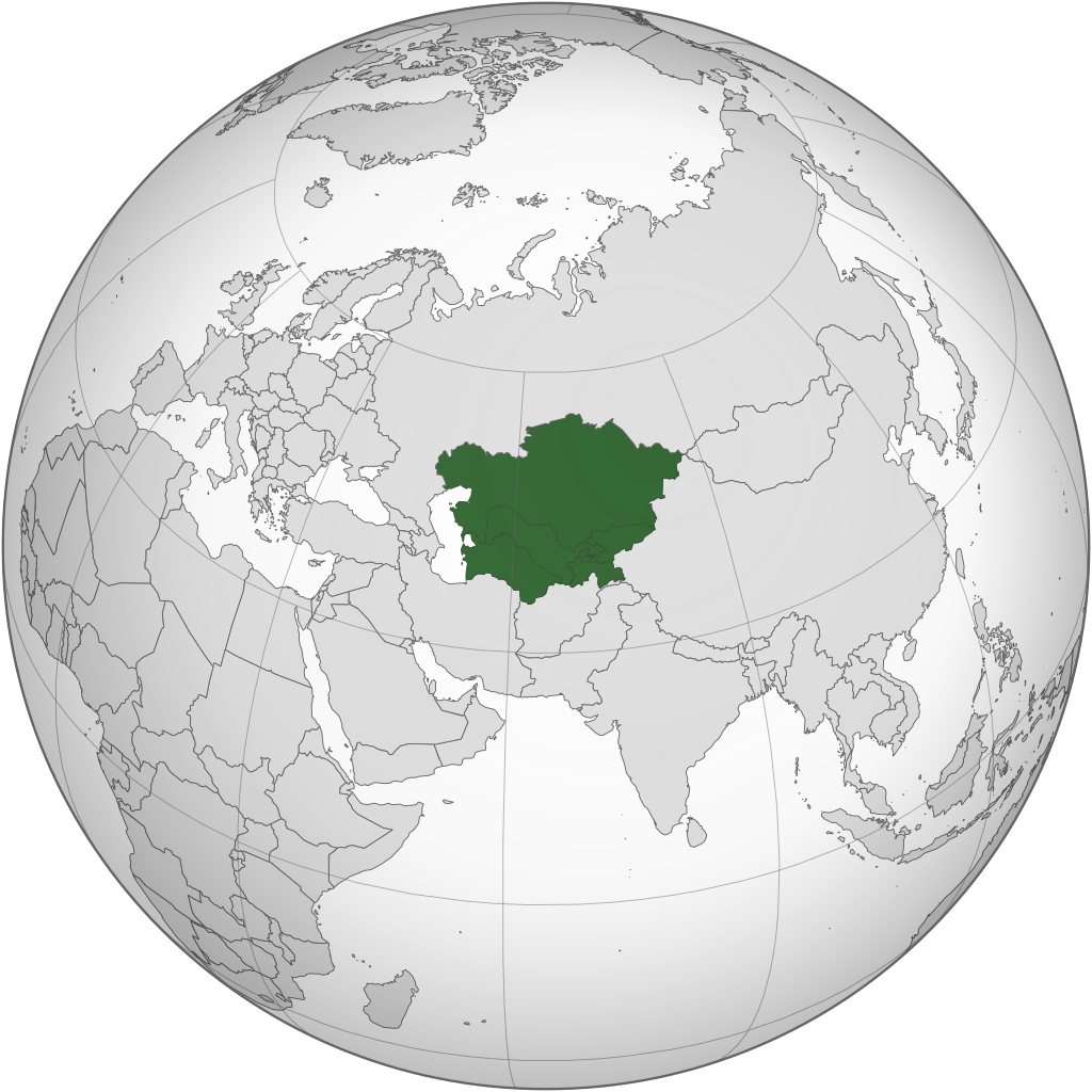
English: Central Asia with national borders Español: Asia Central con bordes |
| Arange | |
| Moõgui oguenohẽ | Iran (orthographic projection).svg |
| Apohára | Serg!o |
| Otras versiones |
.svg) |
| SVG desarrollo |
.svg)
.svg)
.svg)
.svg)
.svg)
.svg)
.svg)
.svg)
.svg)
.svg)
.svg)
.svg)
.svg)
.svg)
.svg)
.svg)
.svg)
.svg)
.svg)
.svg)
.svg)
.svg)
.svg)
.svg)
.svg)
.svg)
.svg)
.svg)
.svg)
.svg)
.svg)
.svg)
.svg)
.svg)
.svg)
.svg)
.svg)
.svg)
.svg)
.svg)
.svg)
.svg)
.svg)
.svg)
.svg)
.svg)
.svg)
.svg)
.svg)
.svg)
.svg)
.svg)
.svg)
.svg)
.svg)
.svg)
.svg)
.svg)
.svg)
.svg)
.svg)
.svg)
.svg)
.svg)
.svg)
.svg)
.svg)
.svg)
.svg)
.svg)
.svg)
.svg)
.svg)

.svg)

.svg)

.svg)
.svg)
.svg)
.svg)
.svg)
.svg)
.svg)


.svg)
.svg)
.svg)
.svg)
.svg)
.svg)
.svg)

.svg)
.svg)
.svg)
.svg)
.svg)
.svg)
.svg)
.svg)
.svg)

.svg)
.svg)
.svg)
.svg)
.svg)
.svg)
.svg)
_without_national_boundaries.svg)
.svg)
.svg)
.svg)
.svg)
.svg)
.svg)

.svg)
.svg)
.png)
.svg)
.svg)
.svg)
.svg)

.svg)
.svg)
.svg)
.svg)
.svg)
.svg)
.svg)
.svg)
.svg)
.svg)
.svg)

.svg)
.svg)
.svg)
.svg)
.svg)
.svg)
.svg)
.svg)
.svg)

.svg)
.svg)

.svg)
.svg)
.svg)
.svg)
.svg)
.svg)
.svg)
.svg)
.svg)
.svg)
.svg)
.svg)
.svg)
.svg)
.svg)
.svg)
.svg)
.svg)
.svg)
.svg)
.svg)
.svg)
.svg)
.svg)
.svg)
.svg)
.svg)
_-_Crimea_disputed.svg)
.svg)
.svg)
.svg)
.svg)
.svg)
.svg)
.svg)
.svg)
.svg)
.svg)
.svg)
_political.svg)
.svg)
.svg)
.svg)
.svg)
_-_Crimea_disputed_-_no_borders.svg)
.svg)
.svg)
.svg)
.svg)
.svg)
.svg)
.svg)
.svg)
.svg)
.svg)
.svg)

.svg)
.svg)
.svg)

.png)
.svg)
.svg)
.svg)
.svg)
.svg)
.svg)
.svg)
.svg)
.svg)
.svg)
.svg)
.svg)
.svg)
.svg)
.svg)
.svg)
.svg)
.svg)
.svg)
.svg)
.svg)
.svg)
.svg)
.svg)
.svg)
.svg)
.svg)
.svg)
.svg)
.svg)
.svg)
.svg)
.svg)
.svg)
.png)
.svg)
.svg)
.svg)
_(orthographic_projection).png)
.svg)
Licencia
Yo, titular de los derechos de autor de esta obra, la publico en los términos de las siguientes licencias:
Este archivo se encuentra bajo la licencia Creative Commons Genérica de Atribución/Compartir-Igual 3.0.
- Nde reime sãsóme:
- de compartir – de copiar, distribuir y transmitir el trabajo
- de remezclar – de adaptar el trabajo
- Bajo las siguientes condiciones:
- atribución – Debes otorgar el crédito correspondiente, proporcionar un enlace a la licencia e indicar si realizaste algún cambio. Puedes hacerlo de cualquier manera razonable pero no de manera que sugiera que el licenciante te respalda a ti o al uso que hagas del trabajo.
- compartir igual – En caso de mezclar, transformar o modificar este trabajo, deberás distribuir el trabajo resultante bajo la misma licencia o una compatible como el original.

|
Se autoriza la copia, distribución y modificación de este documento bajo los términos de la licencia de documentación libre GNU, versión 1.2 o cualquier otra que posteriormente publique la Fundación para el Software Libre; sin secciones invariables, textos de portada, ni textos de contraportada. Se incluye una copia de la dicha licencia en la sección titulada Licencia de Documentación Libre GNU. |
Puedes usar la licencia que prefieras.
Marandurenda rembiasakue
Ejopy peteĩ ára/aravo rehe rehecha hag̃ua pe marandurenda ojehechaukaháicha upe jave.
.svg&dir=prev)
.svg&offset=20130804183708)
.svg&offset=&limit=20)
.svg&offset=&limit=50)
.svg&offset=&limit=100)
.svg&offset=&limit=250)
.svg&offset=&limit=500)
| Ára/Aravo | Michĩháicha | Tuichakue | Puruhára | Jehaimombyky | |
|---|---|---|---|---|---|
| ko’ag̃agua | 10:30 1 jasykõi 2024 | | 553 × 553 (344 kB) | Rodionov Erel | Reverted to version as of 17:55, 18 November 2022 (UTC) |
| 03:17 25 jasyteĩ 2024 |  | 744 × 1052 (618 kB) | Moosie07 | Reverted to version as of 12:09, 24 August 2020 (UTC) | |
| 17:55 18 jasypateĩ 2022 |  | 553 × 553 (344 kB) | M.Bitton | Reverted to version as of 06:08, 4 September 2020 (UTC): why revert to the 2013 version? | |
| 20:36 11 jasyapy 2022 |  | 553 × 553 (344 kB) | Italyoz484 | Reverted to version as of 18:37, 4 August 2013 (UTC) | |
| 06:08 4 jasyporundy 2020 |  | 553 × 553 (344 kB) | Mann Mann | Reverted to version as of 02:19, 24 August 2020 (UTC) Unnecessary and POV-pushing. There are other maps which includes other definitions. | |
| 12:09 24 jasypoapy 2020 |  | 744 × 1052 (618 kB) | Xerxes1985 | Reverted to version as of 17:01, 19 August 2020 (UTC)There are enough geographers cited in the article including it in Central Asia, furthermore there is a reason why it’s in light green and not green which is also in line with your statement/view(not being an integral part of the core but still being included occasionally in historic terms as in lodernd too) | |
| 02:19 24 jasypoapy 2020 |  | 553 × 553 (344 kB) | PersianV | Reverted to version as of 17:30, 17 March 2015 (UTC) While historically part of Central Asia, the current central asia term internationally and politically considered only the 5 former soviet -stans. | |
| 17:01 19 jasypoapy 2020 |  | 744 × 1052 (618 kB) | Xerxes1985 | Afghanistan in a lighter colour | |
| 17:30 17 jasyapy 2015 |  | 553 × 553 (344 kB) | Flappiefh | Removed Somaliland and Kosovo. Separated Western Sahara and Morroco. | |
| 18:37 4 jasypoapy 2013 |  | 553 × 553 (344 kB) | Flappiefh | Added South Sudan. |
Marandurenda jeporu
La siguiente página usa este archivo:
Marandurenda jepuru opaite tembiapópe
Ko'ã ambue wiki oipuru ko marandurenda:
- Jeporu af.wikipedia.org rehe
- Jeporu ar.wikipedia.org rehe
- Jeporu arz.wikipedia.org rehe
- Jeporu az.wikipedia.org rehe
- Jeporu ba.wikipedia.org rehe
- Jeporu bg.wikipedia.org rehe
- Jeporu bh.wikipedia.org rehe
- Jeporu bn.wikipedia.org rehe
- Jeporu bs.wikipedia.org rehe
- Jeporu cdo.wikipedia.org rehe
- Jeporu ckb.wikipedia.org rehe
- Jeporu cs.wikipedia.org rehe
- Jeporu de.wikipedia.org rehe
- Jeporu el.wikipedia.org rehe
- Jeporu el.wiktionary.org rehe
- Jeporu en.wikipedia.org rehe
- Central Asia
- Asian cuisine
- Template talk:Countries of Asia
- Wikipedia:Userboxes/Location/Asia
- Soviet Central Asia
- Architecture of Central Asia
- Wikipedia:WikiProject Central Asia/Participants
- User:Buaidh/Test4
- Category:Wikipedians interested in Central Asia
- Category:WikiProject Central Asia participants
- Wikipedia:Userboxes/WikiProjects/Regional/03
- Portal:Asia/Central Asia
- Portal:Asia/Map of Central Asia
- List of Asian cuisines
- List of sex worker organizations
- Russian conquest of Central Asia
- User:Ziraro
- Wikipedia:Userboxes/WikiProjects/alphabetical/06
- Template:User from Central Asia/doc1
- Template:User in Central Asia
- Template:User in Central Asia/doc
- Template:User interest Central Asia
- Template:User interest Central Asia/doc
- Template:User WP Central Asia
- Template:User WP Central Asia/doc
- Category:Wikipedians in Central Asia
- Category:Central Asian Wikipedians
- Template:User from Central Asia
- Template:User from Central Asia/doc
- Template:User proud Central Asian
- Template:User proud Central Asian/doc
Ver más uso global de este archivo.
.svg)
.svg)