
Ta'ãnga:Philippines location map.svg

Tamaño de esta previsualización PNG del archivo SVG: 454 × 599 píxeles. Otras resoluciones: 182 × 240 píxeles | 364 × 480 píxeles | 582 × 768 píxeles | 776 × 1024 píxeles | 1552 × 2048 píxeles | 1871 × 2468 píxeles.
Marandurenda moambue'ỹre (archivo SVG, nominalmente 1871 × 2468 píxeles, tamaño de archivo: 2,18 MB)
Resumen
| Mombe'uanga |
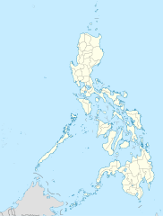
Deutsch: Positionskarte der Philippinen
Quadratische Plattkarte, N-S-Streckung 103 %. Geographische Begrenzung der Karte:
English: Location map of the Philippines
Equirectangular projection, N/S stretching 103 %. Geographic limits of the map:
|
| Arange | |
| Moõgui oguenohẽ |
own work, using
|
| Apohára | NordNordWest |
| Otras versiones |
|


|
Este mapa se ha hecho o mejorado en el Kartenwerkstatt (taller cartográfico) alemán. También puede proponer mapas para mejorar.
|
Licencia
Yo, titular de los derechos de autor de esta obra, la publico en los términos de las siguientes licencias:

|
Se autoriza la copia, distribución y modificación de este documento bajo los términos de la licencia de documentación libre GNU, versión 1.2 o cualquier otra que posteriormente publique la Fundación para el Software Libre; sin secciones invariables, textos de portada, ni textos de contraportada. Se incluye una copia de la dicha licencia en la sección titulada Licencia de Documentación Libre GNU. |
Este archivo se encuentra bajo la licencia Creative Commons Atribución 3.0 Unported.
- Nde reime sãsóme:
- de compartir – de copiar, distribuir y transmitir el trabajo
- de remezclar – de adaptar el trabajo
- Bajo las siguientes condiciones:
- atribución – Debes otorgar el crédito correspondiente, proporcionar un enlace a la licencia e indicar si realizaste algún cambio. Puedes hacerlo de cualquier manera razonable pero no de manera que sugiera que el licenciante te respalda a ti o al uso que hagas del trabajo.
Puedes usar la licencia que prefieras.
Marandurenda rembiasakue
Ejopy peteĩ ára/aravo rehe rehecha hag̃ua pe marandurenda ojehechaukaháicha upe jave.
| Ára/Aravo | Michĩháicha | Tuichakue | Puruhára | Jehaimombyky | |
|---|---|---|---|---|---|
| ko’ag̃agua | 22:17 25 jasyapy 2016 | | 1871 × 2468 (2,18 MB) | Man77 | upd NIR, Davao |
| 11:46 14 jasypa 2013 |  | 1871 × 2468 (2,2 MB) | Hariboneagle927 | fix | |
| 11:07 14 jasypa 2013 |  | 1871 × 2468 (2,15 MB) | Hariboneagle927 | fix. Cagayan | |
| 10:58 14 jasypa 2013 |  | 1871 × 2468 (2,15 MB) | Hariboneagle927 | Made some update and corrected some minor errors. | |
| 07:22 9 jasypa 2013 |  | 1871 × 2468 (2,14 MB) | Hellerick | Regrouped for easier recoloring. | |
| 06:13 7 jasypoapy 2013 |  | 1871 × 2468 (1,07 MB) | Hellerick | Regional division replaced with provincial division. | |
| 19:09 5 jasypokõi 2009 |  | 1871 × 2468 (1009 kB) | NordNordWest | ||
| 21:04 25 jasypo 2009 |  | 1687 × 2469 (999 kB) | NordNordWest | {{Information |Description= {{de|Positionskarte der Philippinen}} Quadratische Plattkarte, N-S-Streckung 103 %. Geographische Begrenzung der Karte: * N: 21.2° N * S: 4.3° N * W: 115.4° O * O: 127.3° O {{en|Location map of the [[:en |
Marandurenda jeporu
No hay páginas que enlacen a este archivo.
Marandurenda jepuru opaite tembiapópe
Ko'ã ambue wiki oipuru ko marandurenda:
- Jeporu af.wikipedia.org rehe
- Jeporu als.wikipedia.org rehe
- Jeporu an.wikipedia.org rehe
- Jeporu az.wikipedia.org rehe
- Jeporu be-tarask.wikipedia.org rehe
- Jeporu be.wikipedia.org rehe
- Jeporu bn.wikipedia.org rehe
- Jeporu ce.wikipedia.org rehe
- Jeporu ckb.wikipedia.org rehe
- Jeporu crh.wikipedia.org rehe
- Jeporu cs.wikipedia.org rehe
Ver más uso global de este archivo.