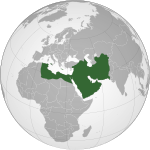
Ta'ãnga:Abbasids850.png

Tamaño de esta previsualización: 800 × 487 píxeles. Otras resoluciones: 320 × 195 píxeles | 640 × 390 píxeles | 1024 × 624 píxeles | 1481 × 902 píxeles.
Marandurenda moambue'ỹre (1481 × 902 píxeles; tamaño de archivo: 50 kB; tipo MIME: image/png)
Marandurenda rembiasakue
Ejopy peteĩ ára/aravo rehe rehecha hag̃ua pe marandurenda ojehechaukaháicha upe jave.
| Ára/Aravo | Michĩháicha | Tuichakue | Puruhára | Jehaimombyky | |
|---|---|---|---|---|---|
| ko’ag̃agua | 10:42 25 jasyapy 2012 |  | 1481 × 902 (50 kB) | Cplakidas | corrections: the eastern half of Sicily was still in Byz. hands, as was Malta. Sardinia and Corsica were raided but never conquered |
| 15:28 22 jasyrundy 2009 |  | 1481 × 902 (50 kB) | Gabagool | some corrections.. | |
| 16:28 21 jasyrundy 2009 |  | 1481 × 902 (50 kB) | Gabagool | {{Information |Description={{en|1=Map of the Abbasid Caliphat at its greatest extent, c. 850. (Partially based on ''Atlas of World History'' (2007) - Progress of Islam, map)}} |Source=Own work by uploader |Author=Gabagool / Jarle Grøhn |
Marandurenda jeporu
La siguiente página usa este archivo:
Marandurenda jepuru opaite tembiapópe
Ko'ã ambue wiki oipuru ko marandurenda:
- Jeporu af.wikipedia.org rehe
- Jeporu als.wikipedia.org rehe
- Jeporu an.wikipedia.org rehe
- Jeporu ar.wikipedia.org rehe
- Jeporu arz.wikipedia.org rehe
- Jeporu ast.wikipedia.org rehe
- Jeporu azb.wikipedia.org rehe
- Jeporu bat-smg.wikipedia.org rehe
- Jeporu be-tarask.wikipedia.org rehe
- Jeporu be.wikipedia.org rehe
- Jeporu bg.wikipedia.org rehe
- Jeporu bn.wikipedia.org rehe
- Jeporu br.wikipedia.org rehe
- Jeporu bs.wikipedia.org rehe
- Jeporu bxr.wikipedia.org rehe
- Jeporu ca.wikipedia.org rehe
- Jeporu cbk-zam.wikipedia.org rehe
- Jeporu ckb.wikipedia.org rehe
- Jeporu cs.wikipedia.org rehe
- Jeporu da.wikipedia.org rehe
- Jeporu de.wikipedia.org rehe
- Jeporu diq.wikipedia.org rehe
- Jeporu en.wikipedia.org rehe
Ver más uso global de este archivo.


